NorthAmericaNEcology @CityOfLosAngeles @Nasa-jpl
Written on April 27, 2026 April 27th, 2026 by RashardKelly @nasa-jpl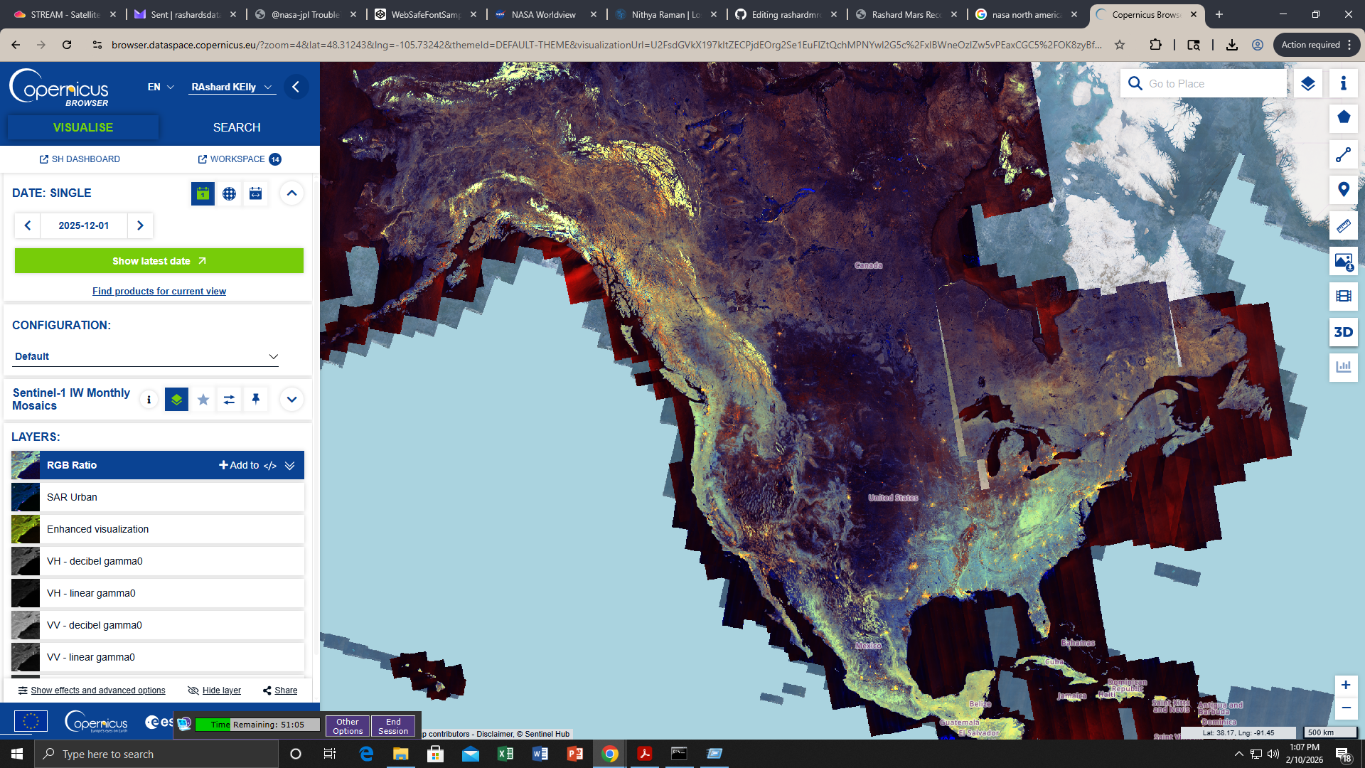
by RashardKelly @nasa-jpl
tags: 27 April 2026
Ecology-NorthAMERiCA!
https://www.darienlibrary.org/
@esa @usgs @UKSpaceAgency FOR _CamiLLA& CHarlsThe3rd @alphagov ~ @whitehouse @la-county-isd @JHUAPL @nasa-jpl @nasa-pdssdo.gsfc.nasa.gov/assets/img/dailymov/2026/04/28/20260428_1024_0171.mp4 Todays Files
GRACE California Terrestrial Water Storage from 2018-06 to 2023-03. https://gracefo.jpl.nasa.gov/ White House State Dinner for King Charles III & Queen Camilla
GRACE measures California water 2002-2017
link NASA’s Gravity Recovery and Climate Experiment (GRACE) mission, launched in 2002, maps changes in Earth’s gravity field resulting from the movement of water over the planet. This animation shows how the total amount of water (snow, surface water, soil moisture, and groundwater) varies in space and time, with the passage of dry seasons and wet seasons as well as with flooding, drought, and transport due to water management. Blue colors represent wetter than average conditions (relative to 2002-2017), while red colors represent drier than average conditions. The yellow line in the graph at left shows the interannual variation for area outlined in ywllow on the map, while the fainter gray line in the graph shows variations with the seasonal cycle included.
@TheSpaceDevs https://ecostress.jpl.nasa.gov/gallerylist share with royal family @nationalarchives @NASA-GiSS Georgia wildfires update from Gov. Brian Kemp watch @nasa-jpl @la-county-isd pineland fire @lacountyDPH /// @CityOfLosAngeles KarenBass royal.uk/news-and-activity/2026-04-28/state-visit-to-the-us-and-bermuda
youtu.be/KrVBP0fL5VU?si=ezEcsr2e4_AokSIg
search.earthdata.nasa.gov/search?
https://github.com/nasa/earthdata-search @UKSpaceAgency hi @eSA @blackgirlscode @eu-cdse
@blackgirlscode @howard-university-web-services @BlueOrigin @TheSpaceDevs https://ecostress.jpl.nasa.gov/gallerylist @NASA-GiSS @emit-sds FULL SPEECH: King Charles III delivers joint address to Congressladsweb.modaps.eosdis.nasa.gov/stream/map#map=13.14/-8570706.69/4703292.86&layers=aqv_tss_20260427_sentinel:1.00:0.00:30.00:default,aqv_chla_20260427_sentinel:1.00:0.00:30.00:default letschat@virtiserv.com
@nasa YESTERDAY @la-county-isd
@whitehouse i hope im in the right place @nasa-jpl https://ladsweb.modaps.eosdis.nasa.gov/stream/map#map=17.84/-8575616.29/4706941.04&layers=aqv_chla_20260427_sentinel:1.00:0.00:30.00:default @la-county-isd . . . @longbeachinnovationteam i hope im not bugging youbut im supposed to keep rex in the loop…
@UKSpaceAgency hi @eSA King Charles III // ladsweb.modaps.eosdis.nasa.gov/stream/map#map=10.67/-8581954.20/4692797.94&layers=aqv_chla_20260427_sentinel:1.00:0.00:30.00:default
@blackgirlscode file for coral erika normani and latrice sartu kashdoll @nasa-jpl @nasa-pds FireyCoalz
~$ curl virtiserv.com
<!DOCTYPE html><html><head><script>window.onload=function(){window.location.href="/lander"}</script></head></html>

~$ curl whitehouse.gov
<html>
<head><title>301 Moved Permanently</title></head>
<body>
<center><h1>301 Moved Permanently</h1></center>
<hr><center>nginx</center>
</body>
</html>
~ $
Part 1 - Introduction and Demonstration of STREAM
surface water egypt link
@newshour @blackgirlscode @NASA-GISS
From hajar oukabli [1] to Everyone 12:07
would it be available to use STREAM products in spain reservoirs?
Link = https://worldview.earthdata.nasa.gov/?v=-17.455042204763462,34.75434825737002,1.8305595555240748,44.326837047762744&l=Reference_Labels_15m,Reference_Features_15m(hidden),Coastlines_15m,MODIS_Terra_L2_Chlorophyll_A,VIIRS_SNPP_L2_Chlorophyll_A,S3B_OLCI_Chlorophyll_a,S3A_OLCI_Chlorophyll_a,OCI_PACE_Chlorophyll_a,VIIRS_NOAA21_Chlorophyll_a,VIIRS_NOAA20_Chlorophyll_a,MODIS_Aqua_L2_Chlorophyll_A,Nuclear_Power_Plant_Locations,GRanD_Reservoirs,GRanD_Dams,OCI_PACE_True_Color(hidden),VIIRS_NOAA21_CorrectedReflectance_TrueColor(hidden),VIIRS_NOAA20_CorrectedReflectance_TrueColor(hidden),VIIRS_SNPP_CorrectedReflectance_TrueColor(hidden),MODIS_Aqua_CorrectedReflectance_TrueColor(hidden),MODIS_Terra_CorrectedReflectance_TrueColor&lg=true&t=2026-02-10-T19%3A28%3A10Z
LAADS DAAC primarily archives and distributes data on clouds, water vapor, and aerosols in Earth’s atmosphere as well as key instrument data for NASA, NOAA and European Space Agency missions. LAADS DAAC also serves as a backup source for MODIS and VIIRS land products. Link + Worldview @nasa @whitehouse @cityoflosangeles @la-county-isd MayorBass
om hajar oukabli to Everyone12:07 would it be available to use STREAM products in spain reservoirs? from rebwar to Everyone12:08 can this program be used for water quality of river from Sarah E. Pearce Canada to Everyone12:08 THANK YOU from Sherrie Morris to Everyone12:08 To ensure we see your question, please locate the three dots … to the bottom right of your training window. You will see a Q&A option. Place all questions there and we will answer them during the Q&A session. from Cecilia to Everyone12:09 How can I access the second section, since I did not receive the email? from Saikat Patra to Everyone12:09 thank you from rashard kelly to Everyone12:10 @ hajar oukabli #SPAiN_RESiViORS https://worldview.earthdata.nasa.gov/?v=-17.455042204763462,34.75434825737002,1.8305595555240748,44.326837047762744&l=Reference_Labels_15m,Reference_Features_15m(hidden),Coastlines_15m,MODIS_Terra_L2_Chlorophyll_A,VIIRS_SNPP_L2_Chlorophyll_A,S3B_OLCI_Chlorophyll_a,S3A_OLCI_Chlorophyll_a,OCI_PACE_Chlorophyll_a,VIIRS_NOAA21_Chlorophyll_a,VIIRS_NOAA20_Chlorophyll_a,MODIS_Aqua_L2_Chlorophyll_A,Nuclear_Power_Plant_Locations,GRanD_Reservoirs,GRanD_Dams,OCI_PACE_True_Color(hidden),VIIRS_NOAA21_CorrectedReflectance_TrueColor(hidden),VIIRS_NOAA20_CorrectedReflectance_TrueColor(hidden),VIIRS_SNPP_CorrectedReflectance_TrueColor(hidden),MODIS_Aqua_CorrectedReflectance_TrueColor(hidden),MODIS_Terra_CorrectedReflectance_TrueColor&lg=true&t=2026-02-10-T19%3A28%3A10Z from rashard kelly to Amita Mehta (privately)12:11 hajar oukabli needs the spanish resiviorss https://worldview.earthdata.nasa.gov/?v=-17.455042204763462,34.75434825737002,1.8305595555240748,44.326837047762744&l=Reference_Labels_15m,Reference_Features_15m(hidden),Coastlines_15m,MODIS_Terra_L2_Chlorophyll_A,VIIRS_SNPP_L2_Chlorophyll_A,S3B_OLCI_Chlorophyll_a,S3A_OLCI_Chlorophyll_a,OCI_PACE_Chlorophyll_a,VIIRS_NOAA21_Chlorophyll_a,VIIRS_NOAA20_Chlorophyll_a,MODIS_Aqua_L2_Chlorophyll_A,Nuclear_Power_Plant_Locations,GRanD_Reservoirs,GRanD_Dams,OCI_PACE_True_Color(hidden),VIIRS_NOAA21_CorrectedReflectance_TrueColor(hidden),VIIRS_NOAA20_CorrectedReflectance_TrueColor(hidden),VIIRS_SNPP_CorrectedReflectance_TrueColor(hidden),MODIS_Aqua_CorrectedReflectance_TrueColor(hidden),MODIS_Terra_CorrectedReflectance_TrueColor&lg=true&t=2026-02-10-T19%3A28%3A10Z from orlando.gonzalez@un.org to Everyone12:11 Is there a procedure for identifying Mercury content un land and rivers affected by gold mining? from Mishelle to Everyone12:11 for odor indicides would that not be a calculation of off gasing so particulate matter in the air quality, it could be estimated for a new data set from SYLVIE ARQUES to Everyone12:11
Latrice, i have homework, i can understand her @isro accent but still missed it doing helpdesk shit @la-county-isd MsHolly if you know latrice mom can you pass her that… i dont want to get run over! @cityoflosangeles @blackgirlscode
@newshour @blackgirlscode @NASA-GISS
from Bhupendra Sen Thakuri to Everyone11:08 Hello ! I am Bhupendra located at Brookings , South Dakota. I am an undergrad research assistant at South Dakota State University. Email: Bhupendra.SenThakuri@jacks.sdstate.edu from rebwar to Everyone11:08 hello iam from kurdistan from Vladimir Alarcon to Everyone11:09 Hi All. Here Water Quality modeler at Mississippi State University. from Taylor Josephy to Everyone11:09 Hello all - Taylor Josephy, a Watershed Geomatics Specialist with the Government of British Columbia, Canada from Francis to Everyone11:09 Hello, Francis from Ghana from Elizabeth Desser to Everyone11:09 Hi, Elizabeth Desser in Bozeman, MT USA from Elizabeth Desser to Everyone11:09 . from Sarah E. Pearce Canada to Everyone11:10 If anyone is interested in my nature, science and astronomy centre in NB, Canada for collaborations on fireflies, beaver watershed health etc please do contact me pearcesarahelizabeth@gmail.com MSc RS, MSc Astronomy from Alyssa Freedman to Everyone11:10 Hello, my name is Alyssa Freedman, and I am a Watershed Protection Specialist at Anacostia Riverkeeper in Washington, DC. from Kacper to Everyone11:10 Hello, I am Kacper Michalak, I am a GIS tech 1 and a graduate student beginning my masters in Geospatial intelligence at University of Maryland from mauricio to Everyone11:10 I checked the link, but the presentation is not avaidable from Alfonso Navarro Carvallo to Everyone11:10 Greetings for all from Peru and Chile CEO CSO and Educator in EliteSDGs Business Consulting from Christina Buffington to Everyone11:11 Hello from University of Alaska Fairbanks, Geographic Information Network of Alaska (also teach watershed management). I used to live in Helena, Montana and am familiar with Canyon Ferry Lake. Great to see it with satellite products. from Saad Arkkou to Everyone11:12 Hello everyone, I am Saad from Morocco, PhD candidate in marine sciences, specialized in hydro-sedimentary dynamics and port engineering from Natasha Johnson-Griffin to Everyone11:12 @Mauricio, are you able to try another browser? I just double checked and it opened for me in chrome. You can also try this: https://earthdata.nasa.gov/s3fs-public/2026-02/ARSET-STREAM2026-part1-slides.pdf from Jonathan Trujillo to Everyone11:13 Hello, i’m Jonathan Trujillo from México. UAV remote sensing operator, specialized in multispectral images analysis. from mauricio to Everyone11:13 Yes, this is what appears to me: The host or presenter would like Webex Meetings to open a website on your computer. Cisco is not responsible for the content or availability of external sites. We recommend that you make sure this website content is from a trusted source. If you view this page or go to this site, you will be subject to the privacy policy and terms and conditions of the destination site. Destination site: https://earthdata.nasa.gov/s3fs-public/2026-02/ARSET-STREAM2026-part1-slides.pdf from Natasha Johnson-Griffin to Everyone11:15 You will need to click ok to move forward to see the slides. from Rita to Everyone11:15 Hello from Argentina from Sarah E. Pearce Canada to Everyone11:17 i sure would from Brock Blevins to Everyone11:18 STREAM: https://ladsweb.modaps.eosdis.nasa.gov/stream/ from kenza to Everyone11:20 are these tools suitable for beginner in remote sensing?! from Natasha Johnson-Griffin to Everyone11:25 To ensure we see your question, please locate the three dots … to the bottom right of your training window. You will see a Q&A option. Place all questions there and we will answer them during the Q&A session. from Vladimir Alarcon to Everyone11:27 Here Alfred Alvarado Anderson, was not able to connect but I am attendng together with Vladimir. from rashard kelly to Everyone11:27 the filtering is awful in long beach from Bille Jean 205.154.246.88 is the external Decimal:3449484888 Hostname:lib-03-subnet-88.rdns.cenic.net ASN:2152 ISP:CENIC Services:None detected Country:United States State/Region:California City:Cypress Latitude:33.8170 (33° 49′ 1.05″ N) Longitude:-118.0373 (118° 2′ 14.25″ W) from rashard kelly to Everyone11:27 host Microsoft Windows [Version 10.0.18362.1256] (c) 2019 Microsoft Corporation. All rights reserved. C:\Users\PAC>ipconfig /all Windows IP Configuration Host Name . . . . . . . . . . . . : MPEIC26 Primary Dns Suffix . . . . . . . : lbpa.local Node Type . . . . . . . . . . . . : Hybrid IP Routing Enabled. . . . . . . . : No WINS Proxy Enabled. . . . . . . . : No DNS Suffix Search List. . . . . . : lbpa.local Ethernet adapter Ethernet: Connection-specific DNS Suffix . : Description . . . . . . . . . . . : Intel(R) Ethernet Connection (7) I219-LM Physical Address. . . . . . . . . : E4-54-E8-71-87-47 DHCP Enabled. . . . . . . . . . . : No Autoconfiguration Enabled . . . . : Yes IPv4 Address. . . . . . . . . . . : 192.168.161.126(Preferred) Subnet Mask . . . . . . . . . . . : 255.255.254.0 Default Gateway . . . . . . . . . : 192.168.160.1 DNS Servers . . . . . . . . . . . : 192.168.129.12 192.168.128.12 NetBIOS over Tcpi from Carlos Andres Rios-Franco to Everyone11:28 I’m getting “504 Gateway Time-out” from Kaden Caliendo he/him to Everyone11:28 I think all of us trying is making it time out from Kaden Caliendo he/him to Everyone11:28 I have the same thing’ from Vladimir Alarcon to Everyone11:29 Arewe going to have the video of this presentation? from Natasha Johnson-Griffin to Everyone11:29 For thos having issues with access: We will have the recording up on the training’s webpage here: https://www.earthdata.nasa.gov/learn/trainings/monitoring-water-quality-lakes-coastal-regions-using-stream within 48 hours for you to view. from Sarah E. Pearce Canada to Everyone11:32 I have a location at 296 days corner road NB, there are very small waterbodies–can I use these tools there? from Mishelle to Everyone11:32 Thank you William from Sarah E. Pearce Canada to Everyone11:32 thank you from Rayane to Everyone11:32 👏🏾 from Saad Arkkou to Everyone11:32 Thank you from Natasha Johnson-Griffin to Everyone11:32 Hello, yes you will qualify. Please allow 2 months to receive certificate via email. from Badr Nachchach to Everyone11:32 Thank you William it was clear from Anfel Benyoucef to Everyone11:32 the pdf’s link please from Ban AL Hasani to Everyone11:32 Many thanks from hajar oukabli to Everyone11:32 Thank you from William Wainwright to Everyone11:33 I’m looking into deploying more instances for STREAM to handle the traffic right now, thank you all from bakhouche wail to Everyone11:34 thanks MR .william from Amina Abi to Everyone11:35 complete beginner here , what do they man by tile list please from orlando.gonzalez@un.org to Everyone11:35 hello, everyone I am Orlando González from United Nación Office no Drugs and Crime, Colombia from rashard kelly to Everyone11:39 504 Gateway Time-out nginx The HTTP 504 Gateway Timeout server error response status code indicates that the server, while acting as a gateway or proxy, did not get a response in time from the upstream server in order to complete the request @mozilla MDN - 504 Gateway Timeout HTTP response status codes LiST @blackgirlscode @NASA-GISS @howard-university-web-services Informational responses (100 – 199) Successful responses (200 – 299) Redirection messages (300 – 399) Client error responses (400 – 499) Server error responses (500 – 599) https://ladsweb.modaps.eosdis.nasa.gov/stream/map#map=9.81/-13297027.93/4863070.84&grids=1,0 from William Wainwright to Everyone11:39 Update: STREAM should be a little more stable with the increased traffic from William Wainwright to Everyone11:40 please check again if you received any errors from Kacper to Everyone11:41 Hello, where can I find the tutorial to download QGIS and the plugins mentioned? from Natasha Johnson-Griffin to Everyone11:42 @Kacper QGIS Download and Install tutorial: https://arset.unhosting.site/course/view.php?id=29 from IsmayilZeynalov to Everyone11:42 Thank you for the invitation! from Kacper to Everyone11:42 Thank you from khiati to Everyone11:44 thank u from rashard kelly to Everyone11:45 NONDiSRUPTiVE_HELPDESK_FOR_STRANDED_STUDENTS https://archive.org/download/mars-geology-imaging-gifs_202602/VID_20260210_114125_210.mp4 from Carlos Andres Rios-Franco to Everyone11:46 I’m looking for STREAM products for Colombia, but I can’t find them. In which areas of the world is STREAM available? from Jiheon Scarlett Lee to Everyone11:46 Hello ! Everyone! My name is Jiheon Lee who is a Ph.D. candidate in Urban and environmental Engineering Dept. in South Korea. My specific research area is Climate change adaptative strategic scenario development in IWRM using watershed model and AI model in small sized basin area. My email address is urbanholic2014@gmail.com. Good to meet you all. from Shambel to Everyone11:47 Is that an average value of the ROI? from rashard kelly to Everyone11:47 tracert if u on windows traceroute if you are on linux/osx/*nix from Natasha Johnson-Griffin to Everyone11:47 To ensure we see your question, please locate the three dots … to the bottom right of your training window. You will see a Q&A option. Place all questions there and we will answer them during the Q&A session. from rashard kelly to Everyone11:47 C:\Users\PAC>tracert ladsweb.modaps.eosdis.nasa.gov Tracing route to ladsweb.modaps.eosdis.nasa.gov [198.118.194.40] over a maximum of 30 hops: 1 <1 ms <1 ms <1 ms 192.168.160.1 2 * * * Request timed out. 3 * * * Request timed out. 4 * * * Request timed out. 5 * * * Request timed out. 6 * * * Request timed out. 7 * * * Request timed out. 8 * * * Request timed out. 9 * * * Request timed out. 10 * * * Request timed out. 11 * * * Request timed out. 12 * * * Request timed out. 13 * * * Request timed out. 14 * * * Request timed out. 15 * * * Request timed out. 16 * * * Request timed out. 17 * * * Request timed out. 18 * from Natasha Johnson-Griffin to Everyone11:47 To ensure we see your question, please locate the three dots … to the bottom right of your training window. You will see a Q&A option. Place all questions there and we will answer them during the Q&A session. from rashard kelly to Everyone11:47 open the dos cmd to run tracert from Joan Dagnino Flores to Everyone11:47 Hi everyone. I’m Joan Dagnino Flores,environmental engineer from Alas Peruanas University. Email: deynos80@gmail.com from rashard kelly to Everyone11:48 Press the “Windows+R” button combination on your keyboard and type in cmd …. “cmd” from Vladimir Alarcon to Everyone11:49 Do we have the sripts available at the webssite? from Vladimir Alarcon to Everyone11:50 . from Munguleni Isaac to Everyone11:50
504 Gateway Time-out
nginx
The HTTP 504 Gateway Timeout server error response status code indicates that the server, while acting as a gateway or proxy, did not get a response in time from the upstream server in order to complete the request
- @mozilla MDN - 504 Gateway Timeout
HTTP response status codes
LiST @blackgirlscode @NASA-GISS @howard-university-web-services
Informational responses (100 – 199)
Successful responses (200 – 299)
Redirection messages (300 – 399)
Client error responses (400 – 499)
Server error responses (500 – 599)
https://ladsweb.modaps.eosdis.nasa.gov/stream/map#map=9.81/-13297027.93/4863070.84&grids=1,0
@la-county-isd @nasa-jpl @nasa-develop @nasa-giss @nasa-pds @blackgirlscode @cityoflosangeles @StateofCalifornia @nasa @Whitehouse @deptofdefense @dhs-gov @atfweb @atf-web
from Vladimir Alarcon to Everyone11:27
Here Alfred Alvarado Anderson, was not able to connect but I am attendng together with Vladimir.
from rashard kelly to Everyone11:27
the filtering is awful in long beach from Bille Jean 205.154.246.88 is the external Decimal:3449484888 Hostname:lib-03-subnet-88.rdns.cenic.net ASN:2152 ISP:CENIC Services:None detected Country:United States State/Region:California City:Cypress Latitude:33.8170 (33° 49′ 1.05″ N) Longitude:-118.0373 (118° 2′ 14.25″ W)
from rashard kelly to Everyone11:27
host Microsoft Windows [Version 10.0.18362.1256] (c) 2019 Microsoft Corporation. All rights reserved. C:\Users\PAC>ipconfig /all Windows IP Configuration Host Name . . . . . . . . . . . . : MPEIC26 Primary Dns Suffix . . . . . . . : lbpa.local Node Type . . . . . . . . . . . . : Hybrid IP Routing Enabled. . . . . . . . : No WINS Proxy Enabled. . . . . . . . : No DNS Suffix Search List. . . . . . : lbpa.local Ethernet adapter Ethernet: Connection-specific DNS Suffix . : Description . . . . . . . . . . . : Intel(R) Ethernet Connection (7) I219-LM Physical Address. . . . . . . . . : E4-54-E8-71-87-47 DHCP Enabled. . . . . . . . . . . : No Autoconfiguration Enabled . . . . : Yes IPv4 Address. . . . . . . . . . . : 192.168.161.126(Preferred) Subnet Mask . . . . . . . . . . . : 255.255.254.0 Default Gateway . . . . . . . . . : 192.168.160.1 DNS Servers . . . . . . . . . . . : 192.168.129.12 192.168.128.12 NetBIOS over Tcpi
from Carlos Andres Rios-Franco to Everyone11:28
I'm getting "504 Gateway Time-out"
from Kaden Caliendo he/him to Everyone11:28
I think all of us trying is making it time out
from Kaden Caliendo he/him to Everyone11:28
I have the same thing'
REmote Aquatic Chlorophyll-a Tracker (REACT)
This tool is designed to display the probability that aquatic chlorophyll-a > (exceeds) 10 micrograms per liter (µg/L). Probabilities are computed from aquatic reflectance from 10-meter Sentinel-2 satellite imagery.
Idaho @blackgirlscode Latrice …
@usgs i sent my at one point girlfirends town in ohio some scans from @eu-cdse Copernicus take a look at this archive and get the .zip https://archive.org/download/2025-12-20-00-00-2025-12-20-23-59-sentinel-2-l-2-a-true-color/ohio_latrice_virtiserv_earthdata_NASA_JPL-GLENN.zip, Lake Erie while our editors mention it being Rich in quartz, limestone, and algae theres heavy deposits around Cleaveland that may need local attention ill send out an email MrsBass @nasa-jpl @nasa-pds
Laurentians
land disturbances dec20link 22
Early Holocene drought in the Laurentian Great Lakes basin caused hydrologic closure of Georgian Bay - research gate @swot-community @blackgirlscode @nasa-jpl Stream
explore
MAPPiNG @CityOfLosAngles Trees @StateOfCalifornia
RAshard iMAn Kelly M _ R _ O NASAEARTHDATA / JUNO ~ ECOSTRESS iSS
     ___    _____     ___
    /_ /|  /____/ \  /_ /|       Horizons On-line Ephemeris System v4.98d
    | | | |  __ \ /| | | |       Solar System Dynamics Group
 ___| | | | |__) |/  | | |__     Jet Propulsion Laboratory
/___| | | |  ___/    | |/__ /|   Pasadena, CA, USA
|_____|/  |_|/       |_____|/
@blackgirlscode @cityoflosangeles
Rushing river
NBC News 8hrs of coverage of rushing river - watch Thermal
The rain let up around 2am downtown. Riding into longbeach there was a thick low fyling cloud that gave us a foggy ride in. The ComptonCreek is now muddy and the Los Angeles River is about two feet lower and the water is flowing slower . . . @SWOT-community hi I have to keep up with the river because @LACMTA sometimes has water on the tracks and M_R_O assigned me to the NasaFireDept, and gave me a NasaEarthdataLogin and guidance to explore FireSensingTech and this year i made great contributions to The Local Newspapers with forensic data for housing the homeless in safe habitats and diagnosing brush fire files: ComtonCreek 12/27 ; LosAngelesRiver 12/27 -rashard @nasa-jpl @weather-gov @cityoflosangeles @la-county-isd @blackgirlscode i sent normani a letter on @tumblr … @howard-university-web-services I hope im not bugging you, she is a girl, latrice that is and everything will stop the bugabooing and everything. some girl from her pretty girl tribe got kidnapped in atlanta an they playing some sort of evil board game to get her back and some ppl identity clear for some people that no one can find … I recently forked @meta facebookresearch/EgoBlur, I have to look at the deeper software to figure out how ppl thinking on Facebook, any platoform that is, but this really caught my attention
ThisRepositoryContains a command-line interface(CLI) that can detect and blur out faces and license plates(PII) from images and videos. The CLI takes an image or video file as input, runs an anonymization algorithm on it, and writes the blurred output to a specified path. @nasa-jpl @blackGirlsCode im scared of this one so im forking it! @NASA-PDS
anyway looking at @usgs WaterDashBoard The dam output dropped, i have to keep moving, i hope to track this storm across the missisippi , whats a cloud made up of, its a long term thing… i just dont want to be slammed with due dates man
Thermal Anomalies - Firms : ThermalAnomolies
@cbs-news-data the naming convention for the river footage i captured in the last 18hrs or so is https://ia600307.us.archive.org/10/items/commitmentmaintenance/0000000000_oORivercheKsWaterReport_rashard_NASAJPL_virtiserV_hi_latricE_waterLevelsdown2feet*
Websites To Explore Water and Power Associates Informing the Public about Critical Water and Energy Issues facing Los Angeles and California About The Website Your gateway to L.A.’s water and power history and current issues. Water and Power Associates’ website is a trusted, independent resource for anyone interested in the history and current issues of water and energy in Southern California. It offers:
◆ Objective, non-partisan information on water and power
◆ A vast digital archive of photographs and historical documentation
◆ Educational tools for researchers, students, and civic planners
The website serves as both an advocacy and preservation platform, ensuring that Southern California’s infrastructure story is remembered—and that future policy is shaped with insight. @podaac @nasa-jpl https://waterandpower.org/index.html
Los Angeles Aqueduct Built in 1913, the Los Angeles Aqueduct provides critical water to millions of people. Link : Link https://www.ladwp.com/who-we-are/water-system/los-angeles-aqueduct
Water_for_L.A._Brochure_English
L.A. Aqueduct Conditions Reports
clicking on a station will display a chart of the last five days.
HISTORY OF THE LOS ANGELES RIVER
@newshour Application User Workshop 2017 Report
- bonus 1940s LOS ANGELES & HOLLYWOOD CALIFORNIA
- HOME MOVIE CHINATOWN OLVERA STREET XD95595
- LinK
@stateofCalifornia @cityoflosangeles karen bass / holly mitchell i made a simple water report with an overview of the dam discharge water report! @nasa-jpl @weather-gov @noaa-gov -rashard @nasa-jpl @weather-gov @cityoflosangeles @la-county-isd CLicKHere To Watch VideoFile / Play on Archive.org
map ::: CountyView : StreetHeatMap
San Gabriel River Mouth [1] [2]
Cops in Los Angeles County, CA 1992 : The Real LAPD - Episode 11- Super CopAP006302 : Los Angeles in the 1940s. “Vintage Los Angeles” Hollywood : SOUTHERN CALIFORNIA HOLIDAY 1940s TRAVELOGUE SANTA FE RAILROAD 44214
Map of resivoirs and settlements and dams, its not as complete as @usgs WaterDashboard @la-county-isd
Compton Creek MAP @usgs @nasa @nasa-jpl @googleearth Map

Sanbernadino
fsac 1a34758 https://hdl.loc.gov/loc.pnp/fsac.1a34758

647am I rode through the Santa Fe dam on the train @usgs large reservoirs were full but not all of them , The water rate monitor looks accurate look at the data - the 🗺️ map 🗾
Earlier ~430 I checked the river crossover near Union Station The water was lower than it was when I visited earlier, I could see the concrete but it was still feeling fast and I would have called a shallow if not for the middle channel See photo more @blackgirlscode Virtiserv earthdataRashard ~thakasartu, ~530am as I crossed the bridge little Chinatown and highland Park over the river it was high and flowing strongly from the mountains -rashard @nasa-jpl @weather-gov @cityoflosangeles
 ?@.&
?@.&
@nasa
Time MAchine - Mind in a Spin @blackgirlscode its really wet and a ton of water in the LARiVER @usgs @nasa-jpl @cityoflosangeles @stateofcalifornia, The water dashboard is showing increased discharge at the whittier dam, im going ot upload some footage… SkyZoo Truck Jewels… There was flooding near LATTC WatcHNow high water levels in the Los Angeles River at the Metro Los Angeles Eline Passover WatchNow , TheComptonCreek at the Metro A_LiNE crossover Watch, and the cossover into LongBeach WatchNOW @cbs-news-data @newshour @washingtonpost i really dont know how to communicate man.. its coming # California_Linux: Maintaining Commitment NasaJpl_3arthdata MRO/JUNO:ECOSTRESS-BlackGirlsCodeVID 20251024 024214 336
by Rashard Kelly Archive.oRG - - - Global Active Archive of Large Flood Events, 1985-Present // @nasa Global Water Measurements
portal //// Energy and Water Consumption Analysis for Buildings in LA
Team Members: Yash Kansal, Meera G K, Yeyan Wang, Crystal Wang, Shweta Joshi LiNK - cite @yashkansal97 @weather-gov @noaagov @cityoflosangeles the la river was flowing fast with no rapids away from the mountains in this video watch now taken at the end of the day @blackgirlscode @stateofcalifornia Karen bass
@usgs I use the water dashboard in this vid @cityoflosangeles
 @cityoflosangeles @blackgirlscode @stateofcalifornia
Digital Id
http://hdl.loc.gov/loc.gmd/g4051p.rr003220
NASA’s ECOSTRESS Captures Short-Lived Heat Wave in L.A. Area
July 21, 2025
The heat lingered into the evening hours, as captured by NASA’s Ecosystem Spaceborne Thermal Radiometer Experiment on Space Station ( ECOSTRESS ) instrument. - read
The 1992 Los Angeles riots/uprising
Was a series of riots and civil disturbances that occurred in Los Angeles County, California, United States, during April and May 1992. wiki : wikiTalk
Documentary
- LA 92 Full Doc National Geographic LA92 _ Trailer @natgeosociety
youtube
@netflix @StateOfCalifornia : LongBeach Public Library
Oh no! This title currently isn’t available to watch in your country.+ DiscussionGuide @nasa-jpl @emit-sds @whitehouse @cityoflosangeles @blackgirlscode - The Day After the L.A. Riots (1992 Life & Times Broadcast)
@PBS SoCal Watch - L.A.’s 1992 Civil Unrest: The Causes and Legacy
USC Dornsife College of Letters, Arts and Sciences Watch @NetDem-USC
1992 LA RIOTS @CityOfLosAngeles Harvey Levin - before TMZ - reporting for CBS LA @cbs-news-data @blackgirlscode fb watch
#karenBass im going to listen in, i was kidnapped around this time Essence NASA Jet Propulsion Laboratory https://youtu.be/YqA1Qj2MAu0?si=LfGXpJ5ny6asniiJ #Yo_Latrice sartu is my ibeji twin… i really dont know what it means in america, our village was torn apart and someone blew up our market in a helicopter. I dont know if it was los angeles or somolia but mymomma put on the bunny ears man, an we here! Black Girls Code Normani thats y i can still love you, the shit just hurt Los Angeles County Board of Supervisors and im tired of being tortutrd by people who make bad vacation chioces and catalog shop #RelationshipTruths Virgin Mary Ethiopian Orthodox Tewahedo Cathedral i dont remember church, but i remember people The Ministry of Foreign Affairs of Ethiopia Secretary Sean Duffy
1 # HOLE_TO_ANOTHER_UNiVERSE##############################

2 # TO#################LATrice########################

3 # ANOTHER###############################################

4 # UNiVERSE###@BlackGirLSCode Im plotting Displacement########
LosAnGeles Displacement CSV Data @asfadmin for @cityoflosangeles
CouncilWoman Traci Park - download .csv file
Tink - Fake Love watch
the coast looks cleaner @stateofcalifornia @cityoflosangeles
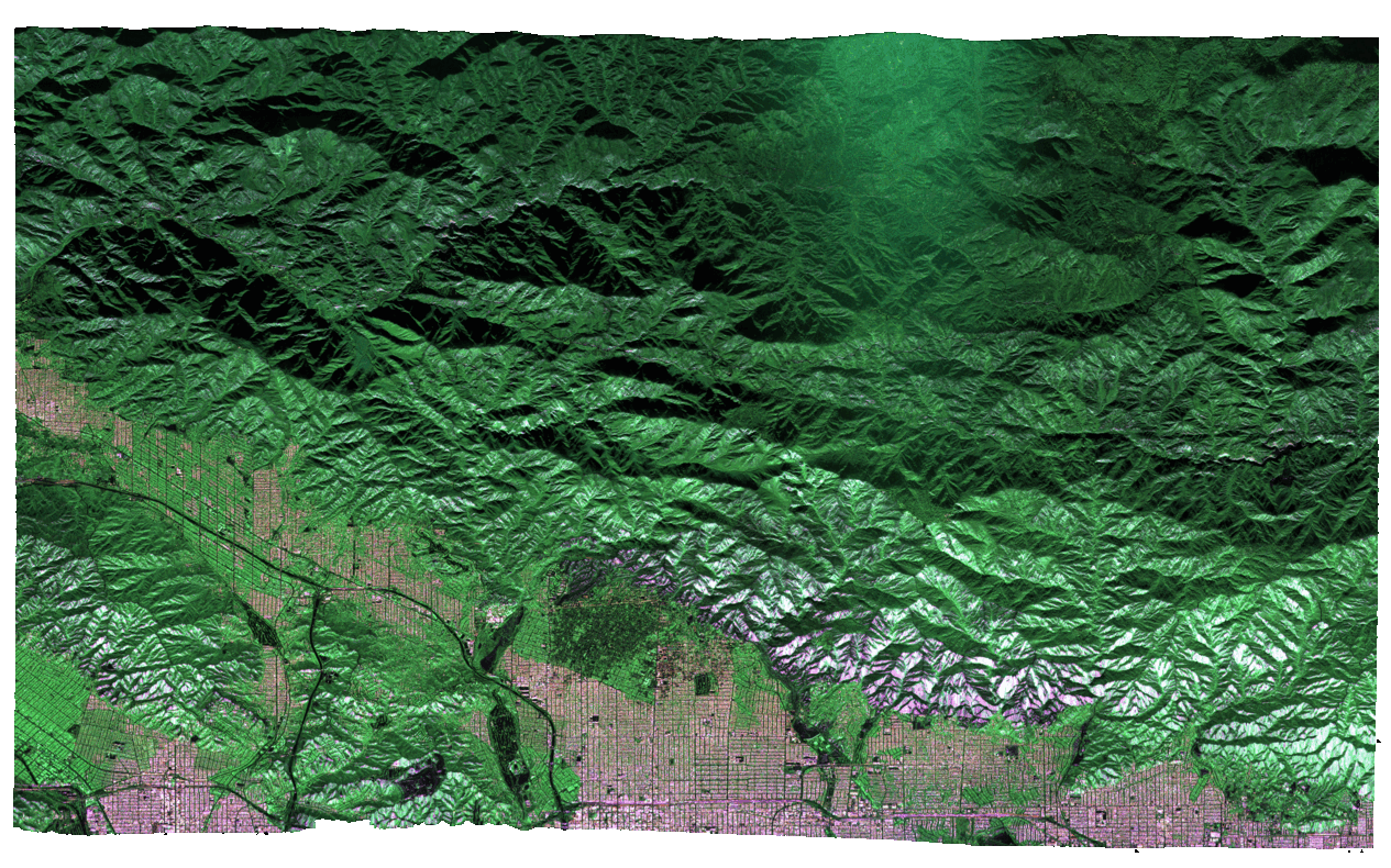
NASA’s Uninhabited Aerial Vehicle Synthetic Aperture Radar (UAVSAR), a reconfigurable, polarimetric L-band SAR, is specifically designed to acquire airborne repeat track SAR data for differential interferometric measurements. Differential interferometry can provide key deformation measurements, and is important for studies of earthquakes, volcanoes, and other dynamically changing phenomena.
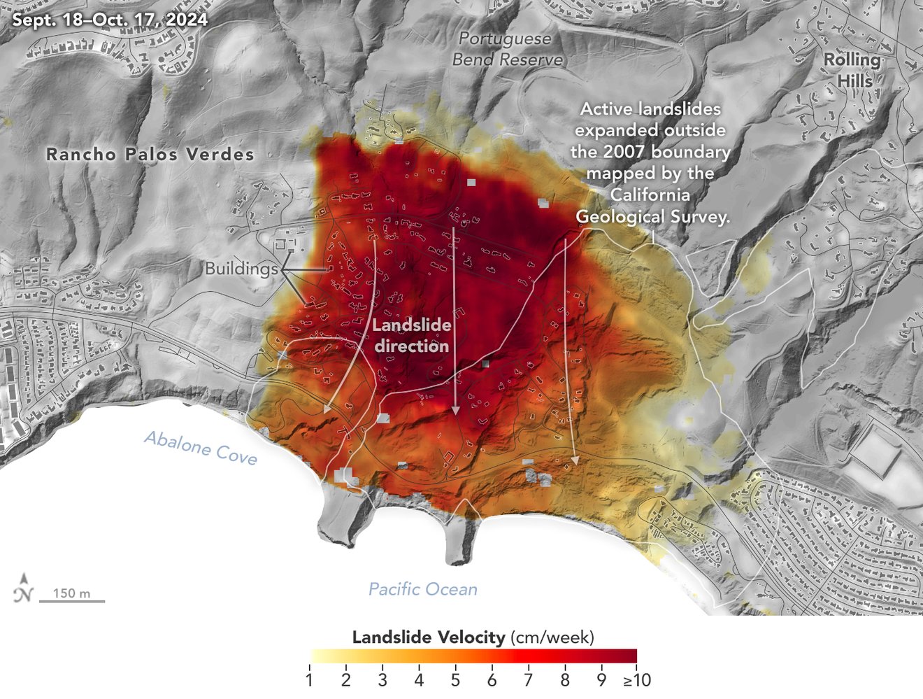
Map of California Subsidence and Uplift Scientists mapped land sinking (indicated in blue) in coastal California cities and in parts of the Central Valley due to factors like soil compaction, erosion, and groundwater withdrawal. They also tracked uplift hot spots (shown in red), including i… Credit: NASA Earth Observatory

NASA’s UAVSAR airborne radar instrument captured data in fall 2024 showing the motion of landslides on the Palos Verdes Peninsula following record-breaking rainfall in Southern California in 2023 and another heavy-precipitation winter in 2024. Darker red indicates faster motion. Credit: NASA Earth Observatory read @nasa-jpl
 @CityOfLosAngeles
Regular City Council - 12/9/25 watch Climate Resilience Districts Overview and Approach PDF ::::::::: SMART_LA PDF / How Will LA Look in 2028? A Look at the City’s Plan To … pdf @cityoflosangeles @emit-sds smartla
Aquatic Report LinK @nasa-jpl inland glendale / hollyrock ; The Palisades ; Eaton Canyon @nasa-jpl @blackgirlscode @datadesk @stateofcalifornia @cbs-news-data @COBIS-HU hi latrice i cant look at tick tok yet im not ready for the news @CityOfLosAngeles @StateOFCalifornia @BlacakGirlsCode there is some way to get ms mitchell and Mayor Bass to see this link. They are really into climate data here Ms Hahn too @nasa-jpl
inducis [California - White Pages - Los Angeles Extended Area - June 1945 A through LANEG Los Angeles on Weather-gov Weather-gov api @blackgirlscode api GitHub
https://rashard-ecostress-jpl-iss.github.io/
layout: default title: HoleToAnotherUniVersE